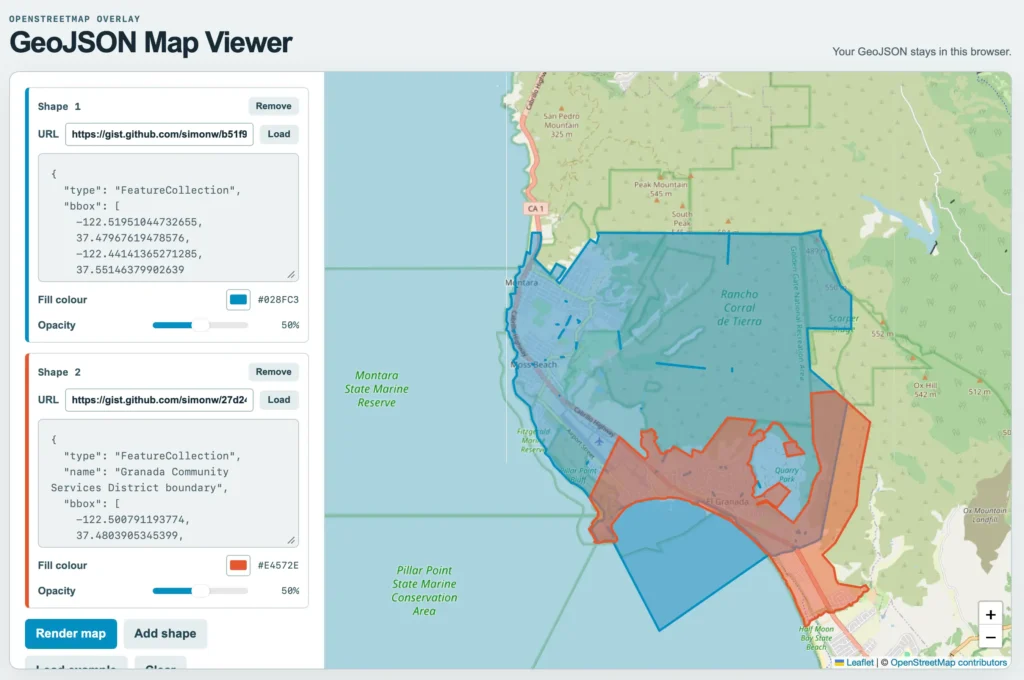
Simon Willison built a new web tool to display and export GeoJSON files as PNG images after GPT-5.6-Sol suggested it while he sought maps for local political boundaries. The application allows users to load multiple shapefiles, adjust their colours and opacity, and render them over an OpenStreetMap base layer. It specifically helped visualise the overlapping areas of the Granada Community Services District and the Midcoast Community Council near Half Moon Bay. The developer used Claude Code and Fable 5.1 to construct the interface, which currently runs entirely within the browser without server uploads.
This matters because it removes a technical barrier for journalists and researchers who need to visualise complex government data quickly. Previously, users had to write code or find specific desktop software to convert raw coordinate files into simple images for reports. The tool also demonstrates how AI agents can now proactively generate functional utilities rather than just answering questions. It highlights a shift where developers provide scaffolding for immediate use instead of requiring users to build their own solutions from scratch.
* The interface supports loading data directly from URLs or pasted text.
* Users can export the final composition as a PNG file.
* The underlying code is available for public inspection and modification.

![Would a new result in pre-print be considered by reviewers? [D]](https://ai-maestro.online/wp-content/uploads/2026/05/would-a-new-result-in-pre-print-be-considered-by-reviewers-d-768x768.jpg)